The six best hikes within reach of Paestum are the Trentova-Tresino coastal paths at Agropoli, the walk to Punta Licosa, the Calore Gorges at Felitto, the climb up Monte Cervati, Campania's highest peak, the Persano WWF Oasis and the trails of Capo Palinuro. From our B&B they are between 25 minutes and one hour forty by car.
The Cilento, Vallo di Diano and Alburni National Park lets you go from Mediterranean scrub above the sea to high beech forests in a single day. We have picked six very different routes, from easy to demanding, each with a fact sheet: difficulty, length, elevation where available, best season and what to pack.
What are the best trails near Paestum?
Here is the overview. Driving times are indicative, measured from the B&B on Via Filette in Capaccio Scalo, without traffic.
| Trail | Difficulty | By car | Best season |
|---|---|---|---|
| Trentova-Tresino (Agropoli) | easy to moderate | 25 min | spring, autumn |
| Punta Licosa (Castellabate) | easy | 40 min | all year |
| Calore Gorges (Felitto) | varies | 45 min | late spring to early autumn |
| Monte Cervati (Sanza) | EE, demanding | 1 h 40 | May to October |
| Persano WWF Oasis | easy | 30 min | all year, on opening days |
| Capo Palinuro | moderate | 1 h 20 | spring, autumn |
1. Trentova-Tresino, Agropoli: the closest coastal trail
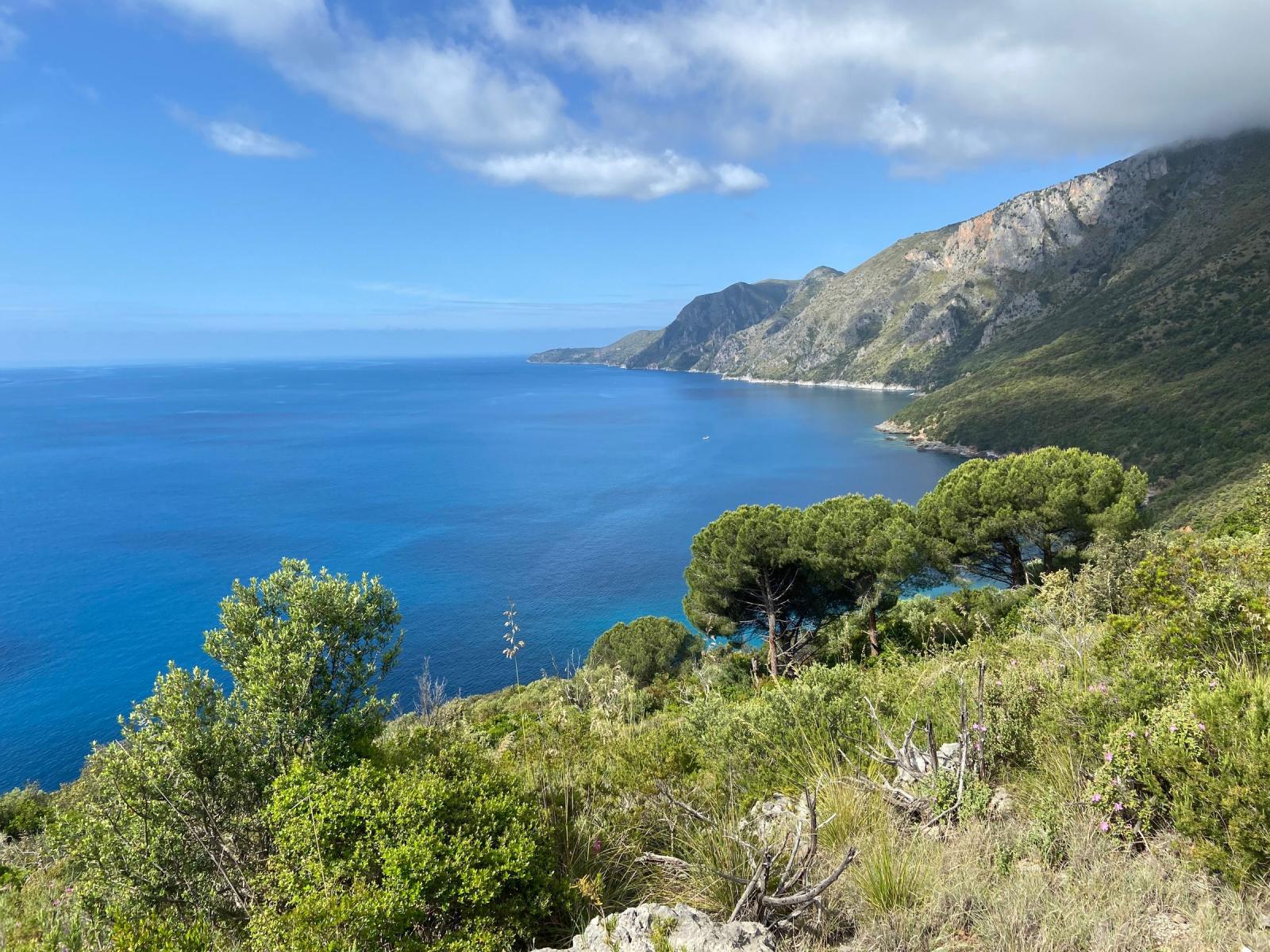
South of Agropoli, above Trentova bay, the Trentova-Tresino visitor centre is the starting point for four waymarked paths across a stretch of coast that has stayed almost untouched: Mediterranean scrub, olive groves and views over the sea. The best known is the Sentiero Trezeni, which runs parallel to the shore for about 7.2 kilometres to Santa Maria di Castellabate. It is one way only, so arrange your return before setting off, with a second car or a lift.
For a shorter outing, take the Sentiero dei Ponti di Pietra, which crosses the scrub above the bay, then walk down to Trentova for a swim in the warmer months. The bay itself features in our guide to the best beaches near Paestum.
| Difficulty | Easy to moderate |
|---|---|
| Length | Sentiero Trezeni about 7.2 km, one way; the other paths are shorter |
| Elevation | Varies |
| Start | Trentova-Tresino visitor centre, above Trentova bay (Agropoli) |
| By car | About 25 minutes |
| Best season | Spring and autumn; little shade in summer |
| What to pack | Shoes with grippy soles, water, a hat, swimwear in the warmer months |
2. Punta Licosa: how do you get there on foot?
Punta Licosa is the headland that closes the Gulf of Salerno to the south, inside the Santa Maria di Castellabate Marine Protected Area. The easiest way to reach it is the coastal path from the harbour of San Marco di Castellabate: about 4.5 kilometres each way, almost all on the flat, through pinewood, scrub and small rocky coves. The approach from Ogliastro Marina, by contrast, follows a private road with a gate that is not always open.
According to myth, the siren Leucosia threw herself into the sea here after Odysseus sailed past, and the islet off the point is her body turned to stone. The islet has a lighthouse, which you cannot reach on foot. There are no facilities along the way, so bring water, a packed lunch, mask and snorkel. Afterwards you can drive up to the hilltop village of Castellabate for sunset, as described in our guide to Cilento's most beautiful villages.
| Difficulty | Easy (T, tourist grade) |
|---|---|
| Length | About 4.5 km each way |
| Elevation | About 40 m |
| Time | 45 minutes to 1 h 30 each way, depending on the source |
| Start | Harbour of San Marco di Castellabate |
| By car | About 40 minutes |
| Facilities | None along the route |
| Best season | All year; start early in summer |
Source: CAI Potenza hike sheet (in Italian). Always check trail conditions before you set off.
3. Calore Gorges, Felitto: where can you swim in the river?
Inland, the Calore Lucano river has carved a limestone gorge near Felitto, with clear water, small waterfalls and natural pools. The village keeps a medieval bridge over the river, near which the paths along the water begin. In summer many hikers stop to swim in the pools: the water stays cool even on the hottest days.
The ground alternates between packed earth and rock, which turns slippery when wet. After heavy rain the river rises and some stretches can become impassable, so postpone if in doubt. Felitto is about 45 minutes by car and, during the opening season, pairs well with a visit to the Castelcivita Caves at the foot of the Alburni mountains.
| Difficulty | Varies with the section you choose |
|---|---|
| Length | Varies |
| Elevation | Varies |
| Start | Felitto, near the medieval bridge |
| By car | About 45 minutes |
| Best season | Late spring to early autumn; avoid the days after heavy rain |
| What to pack | River shoes or sports sandals, a dry bag for phone and documents, swimwear, a towel |
4. Monte Cervati: how hard is the climb to Campania's highest peak?
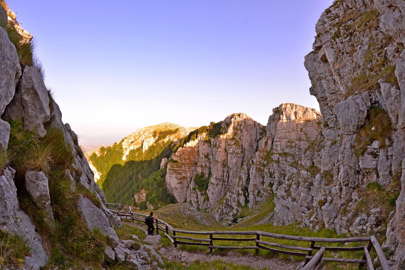
At 1,899 metres, Monte Cervati is the highest summit in Campania and in the Cilento park. The classic route starts from Sanza: you take the votive path up a gully to the Gorla pass, follow the ridges to around 1,600 metres at the foot of the Chiaia Amara, a good place for a rest, then tackle the final stretch to the summit and the Sanctuary of the Madonna della Neve, at about 1,850 metres.
This is a demanding hike: the CAI section of Potenza gives about 11 kilometres and 1,100 metres of ascent, graded EE, meaning for experienced hikers. The stretch from Sanza to the Rifugio Cervati is stage S02 of the CAI Sentiero Italia. If you want something less strenuous, start from Piaggine instead: a loop of about 11 kilometres and 670 metres of ascent, according to routes published on Komoot. On clear days the summit looks out over the Gulf of Policastro, the Vallo di Diano and the mountains of Basilicata.
| Difficulty | EE, experienced hikers |
|---|---|
| Length | About 11 km |
| Elevation | About 1,100 m of ascent |
| Time | A full day |
| Start | Sanza |
| By car | About 1 h 40 to Sanza |
| Best season | May to October; avoid the months with snow and ice |
| What to pack | Hiking boots, poles, a windproof jacket and warm layers even in summer, at least 2 litres of water, a map or GPS track |
Source: CAI Potenza hike programme (in Italian). Mountain conditions change quickly: check before you go.
5. Persano WWF Oasis: nature without the climbing
Not every outing needs boots. The Persano WWF Oasis, about 30 minutes by car, protects some 110 hectares of wetland along the Sele river, between the municipalities of Serre and Campagna. It lies in the Sele plain, just outside the boundaries of the Cilento park. WWF has managed it since 1980, and it is listed under the Ramsar Convention as a wetland of international importance.
It is one of the best places in Campania to see otters, along with many bird species linked to the river and its riverside woods. The paths are flat and suitable for children. The oasis opens only on set days, so check dates and guided visits by phone before you go.
| Difficulty | Easy |
|---|---|
| Length | Varies, paths inside the oasis |
| Elevation | Flat |
| Start | Persano WWF Oasis, between Serre and Campagna |
| By car | About 30 minutes |
| Opening | Set days only (one source lists Wednesday, Saturday and Sunday): check with the oasis, tel. +39 0828 974684 |
| What to pack | Binoculars, neutral-coloured clothing, insect repellent in summer |
6. Capo Palinuro: the Trail of the Forts and Towers
At Palinuro the paths around the headland are known as the Sentieri della Primula, named after Primula palinuri, the park's emblematic flower, or as the Sentiero dei Fortini e delle Torri. They run along cliffs high above the sea and, on CAI routes 806 and 807, reach viewpoints over the bay, the Scoglio del Coniglio and the Torre del Mingardo, one of the coastal watchtowers dotted along this shore.
The loops around the cape measure about 5.7 to 7.2 kilometres, with around 300 metres of ascent. The surface is broken and rocky in places, so you need hiking shoes and a sure foot. After the walk, the sea at Palinuro and the boat trips to the sea caves are just a few minutes away.
| Difficulty | Moderate |
|---|---|
| Length | Loops of about 5.7 to 7.2 km |
| Elevation | About 300 m |
| Surface | Broken and rocky in places |
| Start | Palinuro |
| By car | About 1 h 20 |
| Best season | Spring and autumn; in summer avoid the middle of the day |
| What to pack | Hiking shoes, at least 2 litres of water, a hat, sun cream |
How should you prepare for a hike in the Cilento?
- Check the weather and trail conditions: after heavy rain the Calore Gorges and the mountain paths can become impassable.
- Start early: in summer the heat on the cliffs and at altitude builds quickly; aim to be walking by 8 am.
- Carry plenty of water: fountains along the trails are rare. Allow at least half a litre per hour of walking, more in summer.
- Tell someone where you are going: for the more demanding hikes, share your route and expected return time with someone you trust.
- Respect the park: do not pick plants, carry your rubbish out and do not disturb wildlife. Rules and information are on the website of the Cilento, Vallo di Diano and Alburni National Park.
For Monte Cervati, leave at dawn: you will climb in the coolest hours and reach the top before the afternoon clouds gather. If the weather looks uncertain, switch to Punta Licosa or the Persano Oasis, which are still lovely under a grey sky.
Back at base, a swim in the garden's seasonal pool is the easiest way to loosen tired legs before dinner. If you are planning a walking holiday, have a look at our rooms.
Which trail should you choose?
- For an easy walk with sea views: Punta Licosa (40 minutes by car)
- For a day between coast and scrub: Trentova-Tresino (25 minutes)
- To cool off in summer: Calore Gorges (45 minutes)
- For a mountain challenge: Monte Cervati (1 h 40 to Sanza)
- With children or for birdwatching: Persano WWF Oasis (30 minutes)
- For cliffs and sea views: Capo Palinuro (1 h 20)
For the bigger picture of the protected area, its UNESCO listings and its biodiversity, read our guide to the Cilento National Park.
Frequently asked questions
What is the easiest trail near Paestum?
Punta Licosa from San Marco di Castellabate: about 4.5 kilometres each way, almost entirely flat, around 40 minutes by car from the B&B. Easier still are the flat paths of the Persano WWF Oasis, suitable for children, which opens only on set days.
How demanding is the climb up Monte Cervati?
The classic route from Sanza is about 11 kilometres with 1,100 metres of ascent, graded EE by the CAI: you need experience, good fitness and a full day. The best season runs from May to October.
Can you swim in the Calore Gorges?
Yes, in summer many hikers swim in the natural pools of the Calore near Felitto. Wear river shoes, watch out for slippery rocks and avoid the gorges after heavy rain, when the water level rises.
When is the best time to hike in the Cilento?
Spring and autumn are ideal for the coastal trails. In summer, start at dawn or choose the river gorges; for Monte Cervati the season runs from May to October.